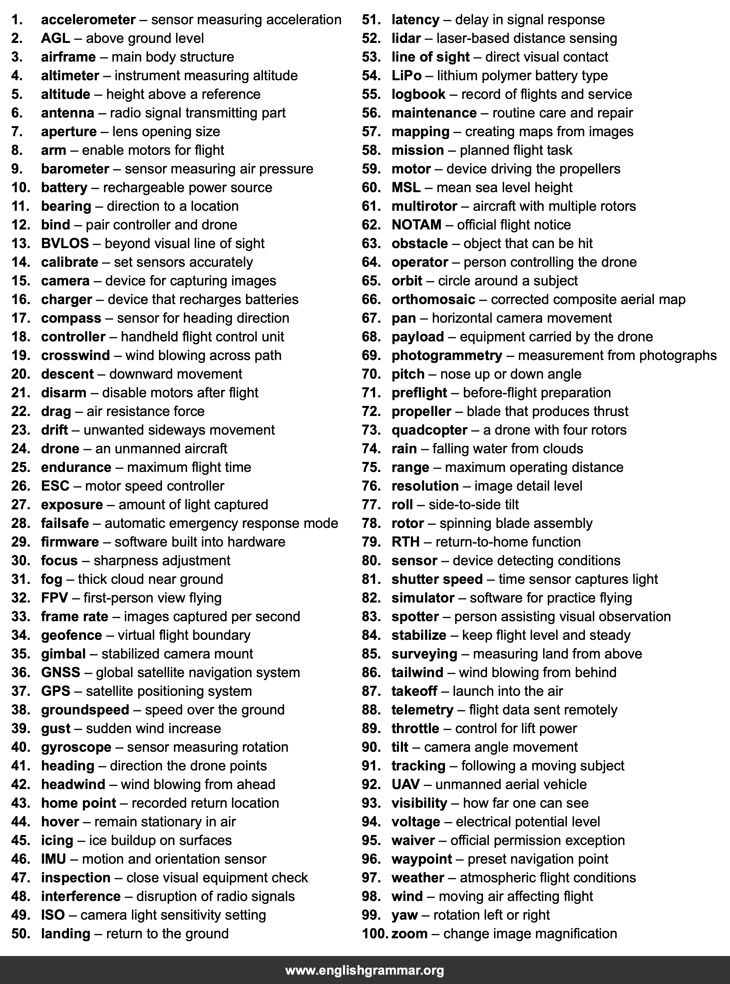
| No. | Item | Definition |
|---|---|---|
| 1. | accelerometer | sensor measuring acceleration |
| 2. | AGL | above ground level |
| 3. | airframe | main body structure |
| 4. | altimeter | instrument measuring altitude |
| 5. | altitude | height above a reference |
| 6. | antenna | radio signal transmitting part |
| 7. | aperture | lens opening size |
| 8. | arm | enable motors for flight |
| 9. | barometer | sensor measuring air pressure |
| 10. | battery | rechargeable power source |
| 11. | bearing | direction to a location |
| 12. | bind | pair controller and drone |
| 13. | BVLOS | beyond visual line of sight |
| 14. | calibrate | set sensors accurately |
| 15. | camera | device for capturing images |
| 16. | charger | device that recharges batteries |
| 17. | compass | sensor for heading direction |
| 18. | controller | handheld flight control unit |
| 19. | crosswind | wind blowing across path |
| 20. | descent | downward movement |
| 21. | disarm | disable motors after flight |
| 22. | drag | air resistance force |
| 23. | drift | unwanted sideways movement |
| 24. | drone | an unmanned aircraft |
| 25. | endurance | maximum flight time |
| 26. | ESC | motor speed controller |
| 27. | exposure | amount of light captured |
| 28. | failsafe | automatic emergency response mode |
| 29. | firmware | software built into hardware |
| 30. | focus | sharpness adjustment |
| 31. | fog | thick cloud near ground |
| 32. | FPV | first-person view flying |
| 33. | frame rate | images captured per second |
| 34. | geofence | virtual flight boundary |
| 35. | gimbal | stabilized camera mount |
| 36. | GNSS | global satellite navigation system |
| 37. | GPS | satellite positioning system |
| 38. | groundspeed | speed over the ground |
| 39. | gust | sudden wind increase |
| 40. | gyroscope | sensor measuring rotation |
| 41. | heading | direction the drone points |
| 42. | headwind | wind blowing from ahead |
| 43. | home point | recorded return location |
| 44. | hover | remain stationary in air |
| 45. | icing | ice buildup on surfaces |
| 46. | IMU | motion and orientation sensor |
| 47. | inspection | close visual equipment check |
| 48. | interference | disruption of radio signals |
| 49. | ISO | camera light sensitivity setting |
| 50. | landing | return to the ground |
| 51. | latency | delay in signal response |
| 52. | lidar | laser-based distance sensing |
| 53. | line of sight | direct visual contact |
| 54. | LiPo | lithium polymer battery type |
| 55. | logbook | record of flights and service |
| 56. | maintenance | routine care and repair |
| 57. | mapping | creating maps from images |
| 58. | mission | planned flight task |
| 59. | motor | device driving the propellers |
| 60. | MSL | mean sea level height |
| 61. | multirotor | aircraft with multiple rotors |
| 62. | NOTAM | official flight notice |
| 63. | obstacle | object that can be hit |
| 64. | operator | person controlling the drone |
| 65. | orbit | circle around a subject |
| 66. | orthomosaic | corrected composite aerial map |
| 67. | pan | horizontal camera movement |
| 68. | payload | equipment carried by the drone |
| 69. | photogrammetry | measurement from photographs |
| 70. | pitch | nose up or down angle |
| 71. | preflight | before-flight preparation |
| 72. | propeller | blade that produces thrust |
| 73. | quadcopter | a drone with four rotors |
| 74. | rain | falling water from clouds |
| 75. | range | maximum operating distance |
| 76. | resolution | image detail level |
| 77. | roll | side-to-side tilt |
| 78. | rotor | spinning blade assembly |
| 79. | RTH | return-to-home function |
| 80. | sensor | device detecting conditions |
| 81. | shutter speed | time sensor captures light |
| 82. | simulator | software for practice flying |
| 83. | spotter | person assisting visual observation |
| 84. | stabilize | keep flight level and steady |
| 85. | surveying | measuring land from above |
| 86. | tailwind | wind blowing from behind |
| 87. | takeoff | launch into the air |
| 88. | telemetry | flight data sent remotely |
| 89. | throttle | control for lift power |
| 90. | tilt | camera angle movement |
| 91. | tracking | following a moving subject |
| 92. | UAV | unmanned aerial vehicle |
| 93. | visibility | how far one can see |
| 94. | voltage | electrical potential level |
| 95. | waiver | official permission exception |
| 96. | waypoint | preset navigation point |
| 97. | weather | atmospheric flight conditions |
| 98. | wind | moving air affecting flight |
| 99. | yaw | rotation left or right |
| 100. | zoom | change image magnification |
